The National Weather Service confirmed that a "confirmed large and extremely dangerous" tornado formed near Raytown, moving east at 45 mph toward Independence.
Residents around the Kansas City metro heard sirens as the storm came in from Johnson County.
The tornado warning has expired for Jackson County and surrounding locations, but a flash flooding threat remains. More rain is forecast to come.
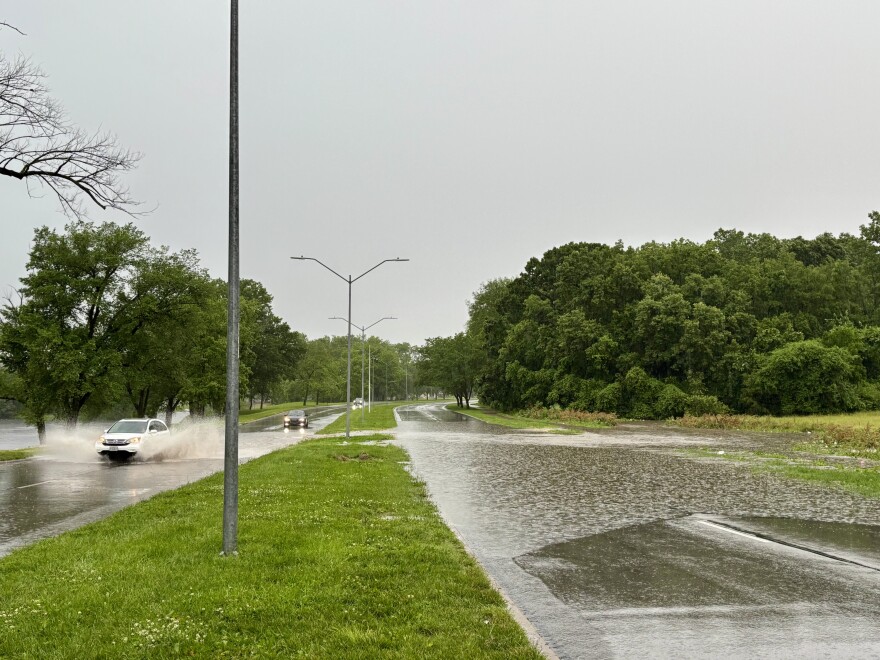
Several semi trucks overturned on highways around Kansas City, according to traffic reports, and some roads remained backed up. Other roads have been closed due to flash flooding.
Impacted locations include Independence, Lee’s Summit, Blue Springs, Grain Valley, Sugar Creek, Buckner, Courtney, Lake Tapawingo, Sibley and Levasy.
The weather service warned of damage to roofs, windows, vehicles and trees. Residents were encouraged to move to a basement or an interior room on the lowest floor of the building. A social media from Kauffman Stadium, near where the tornado was reported to touch down, show small pieces of debris in the air.
Kansas City residents may have heard a second round of tornado sirens around 3 p.m., after the immediate danger appeared to have passed, when the tornado was confirmed to be traveling east near Buckner and Sibley. The Kansas City, Missouri, Fire Department dispatch issued the sirens both times.
The department says both were intentional and were sounded to warn the entire city due to the path of the storm. The first siren was sounded to cover parts of Johnson and southern Jackson counties. The second siren was for the portion of Jackson County remaining on its path.

Two separate tornado warnings came through in Johnson County, Kansas, according to the county emergency management department — first at 1:45 p.m. and then at 2:10 p.m.
Officials there said sirens that were activated only covered the areas of the county that the warning covered. They said there have been some reports of "downed power lines and vegetative debris" in Overland Park.
Last month, sirens in St. Louis failed to activate during a deadly tornado, resulting in the head of the city's emergency management agency being placed on leave.
The emergency preparedness division in Independence said it has teams out surveying reports of damage, although it added that no one has called 911 about downed houses.
Officials said there are some downed trees and power lines, and both the Independence police and fire departments are reporting calls for tree damage.
No major damage was immediately reported on the Kansas side of the metro.

A flash flood warning remains in effect for Jackson, Clay, Platte and several other northwest Missouri counties until 7:30 p.m.
The weather service said that as of 2:38 p.m., between 0.5 and 1.5 inches of rain had fallen in the area, with additional rainfall of 1 to 3 inches possible.
Flash flooding is ongoing or expected to begin shortly, meteorologists said. Residents should not drive into flooded roads.
As of 4:45 p.m., Evergy reports just over 13,000 customers lost power in the Kansas City area, and nearly 2,700 more lost power in Independence and near Buckner.

A flood warning for Stranger Creek at Easton, affecting Leavenworth and Atchison counties in Kansas, is in effect until early Thursday afternoon.
The National Weather Service said the creek was at 15.2 feet as of 3:30 p.m., just shy of the flood stage, which is 17 feet. The river is expected to rise above flood stage this afternoon to a crest of 21.9 feet and then will start to fall on Wednesday.
This is what just went down at Kauffman Stadium pic.twitter.com/gzqN3quAEC
— Quin (@quinswartz) June 3, 2025
TORNADO LIKELY ONGOING MOVING INTO WESTERN INDEPENCENCE NOW. #MOWX
— NWS Kansas City (@NWSKansasCity) June 3, 2025
Tornado Warning including Independence MO, Blue Springs MO and Raytown MO until 3:00 PM CDT pic.twitter.com/LN9XZMfVr2
— NWS Kansas City (@NWSKansasCity) June 3, 2025
This is a breaking news story and may be updated.


